To mark the 70th Anniversary of the D-Day landings, here is one of the projects I have been working on.
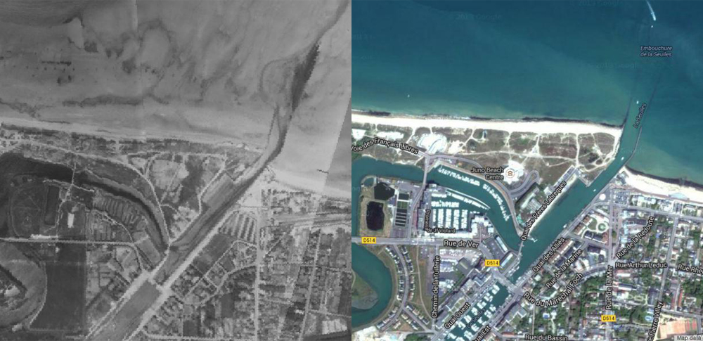
Earlier in the year, the Laurier Military History Archive released thousands of aerial photographs taken during the Second World War. Among the collection was a number of photos taking during reconnaissance missions leading up to June 6, 1944. The following series shows Juno Beach as it appeared on June 4, 1944 and how it appears now.
Click on the image to view the full size. If you look closely, you can see some of the German defensive positions and obstacles of the Atlantic Wall. Note that the Archive’s online collection only includes medium-resolution photos so I apologize that I cannot zoom in any closer at the moment.
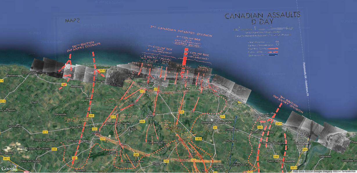
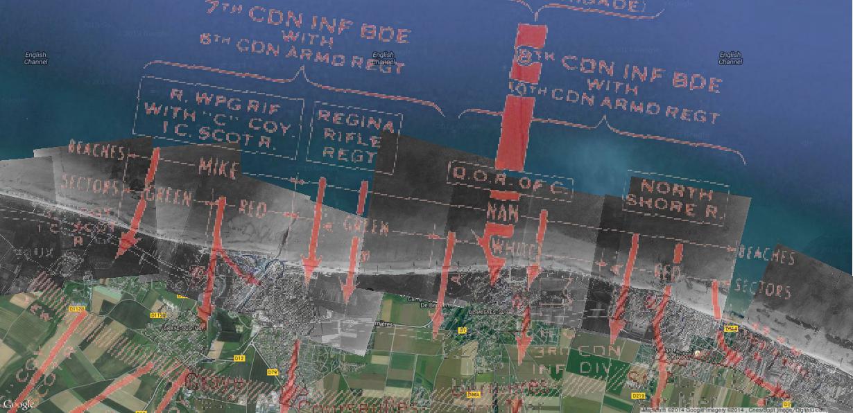
The first two photographs shows a map of the British and Canadian landing beaches (West to East – Gold, Juno, and Sword). The second photograph shows which Regiments landed at Juno in the early morning of June 6, 1944.
The following photographs show the Canadian landing zone from West to East.
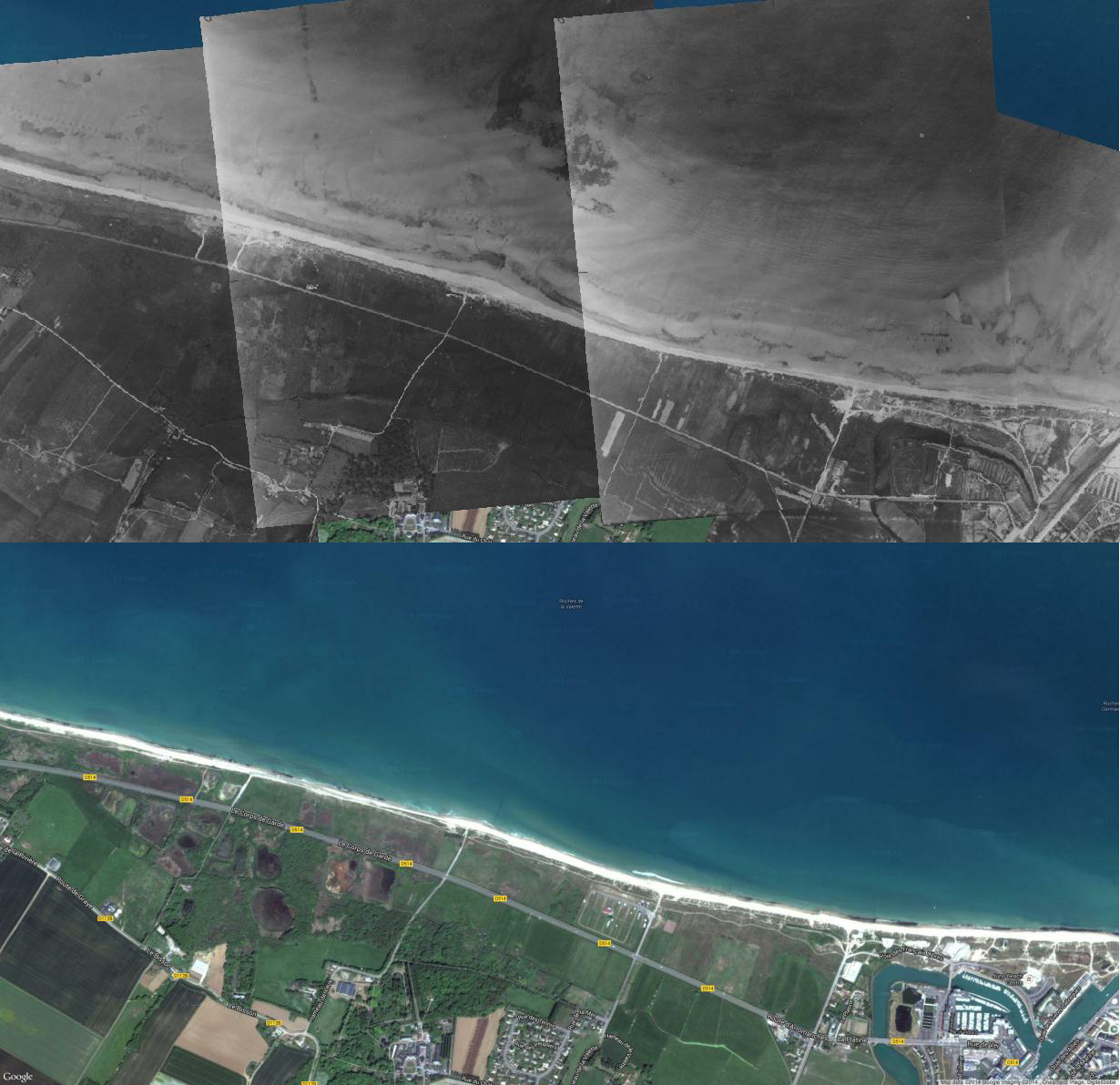
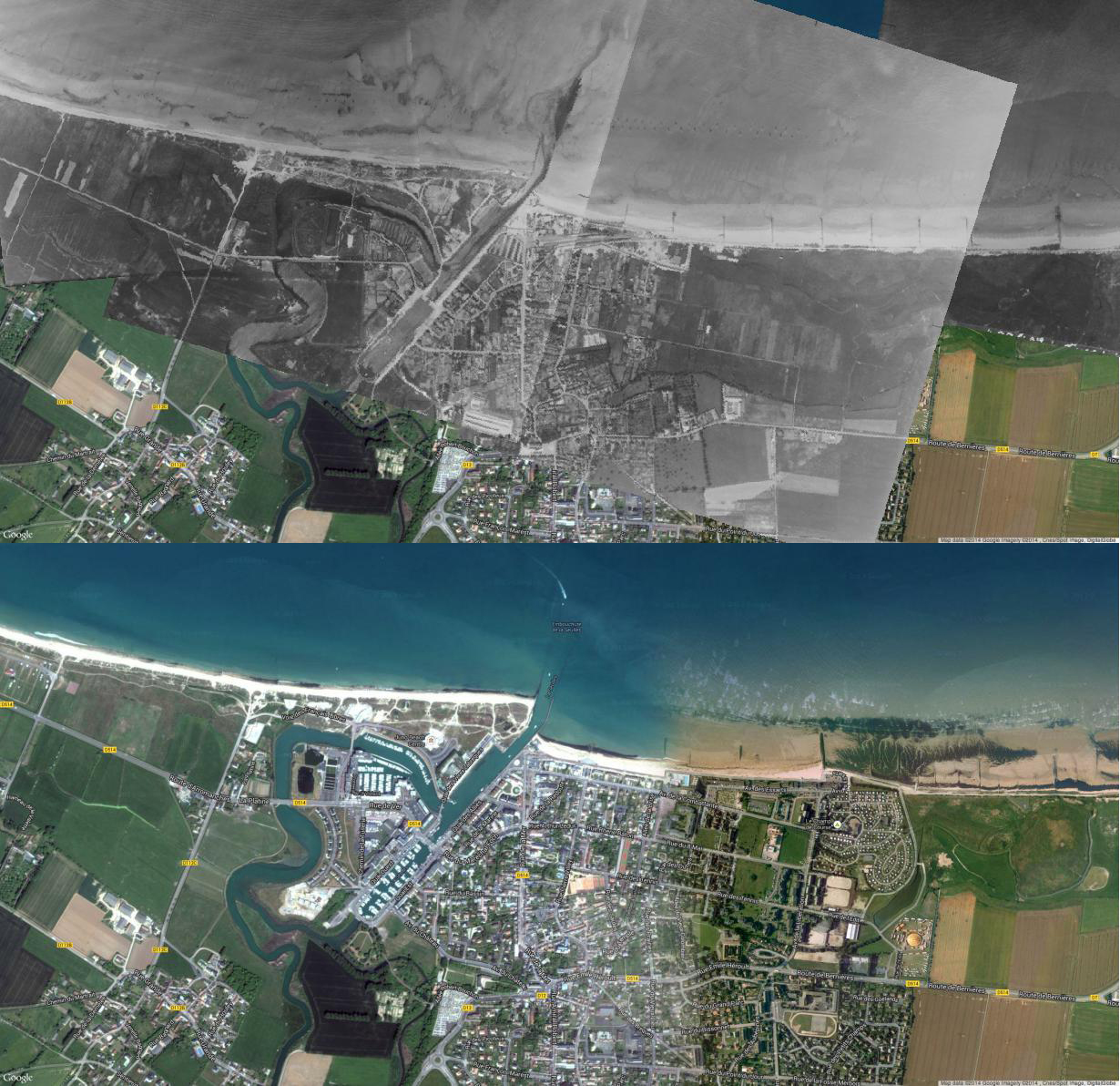

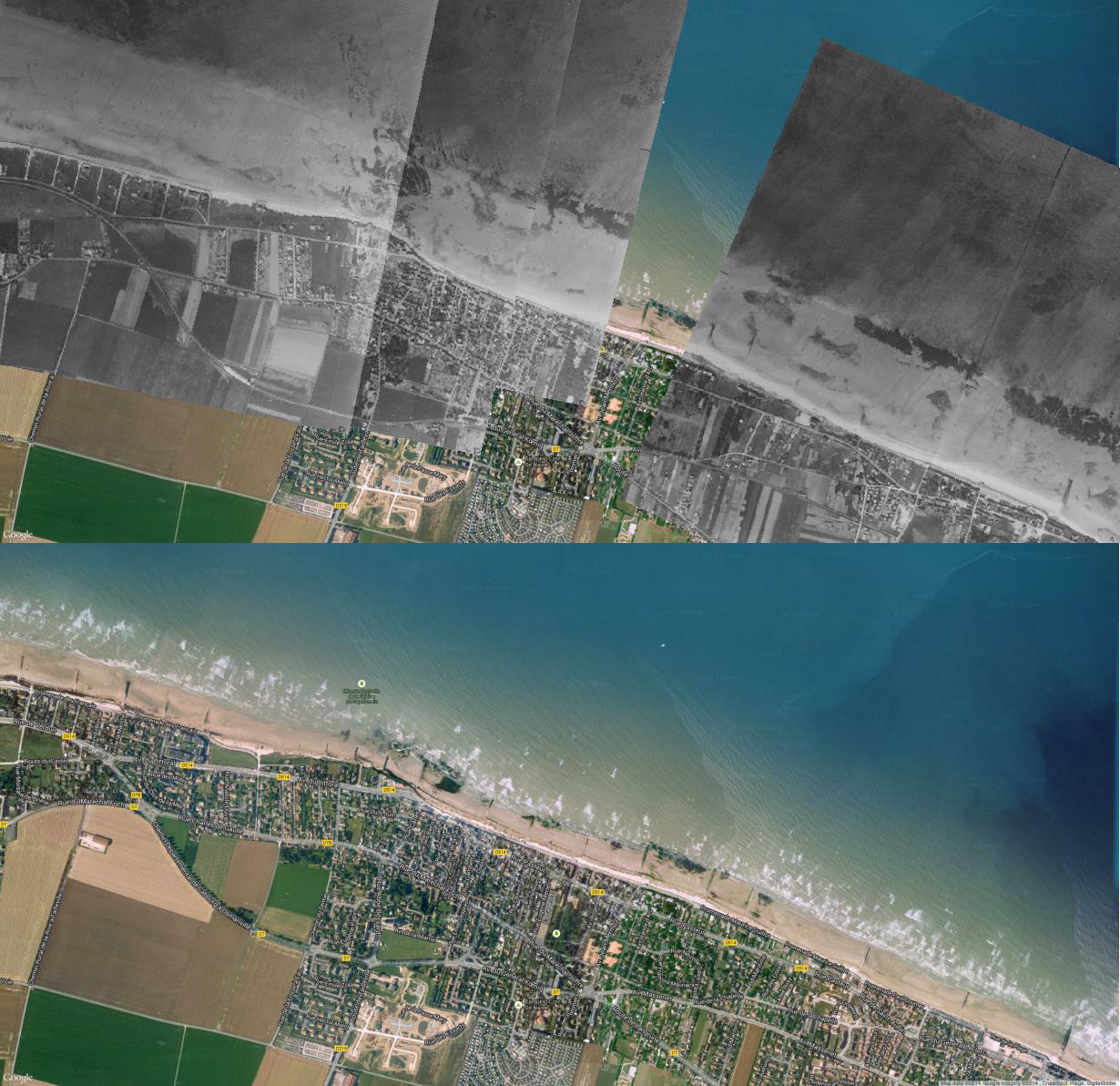
For those who have visited Juno Beach, you may recognize this area. The middle of the two photographs shows the location of the Juno Beach Centre.
Thank you to the Laurier Military History Archive for making these images available on the web and allowing researchers to use them!

May I use these photos in the 2014 edition of the Devils’ Blast. Or can you send a high resolution copy.
Editor, The Devils’ Blast: the Annual Journal of The Royal Winnipeg Rifles
http://mintoarmoury.com/association/the-devils-blast
You sure can! I’ve sent you an email!
You should get a hold of the Thunder Bay Military Museum. They have a fair amt of material including sketches/paintings by a POW who later became quite accomplished.