This past week, in preparation for an upcoming assignment, I’ve been trying my hand at some Historical GIS. I spent the weekend going through the the GIS tutorials at the Geospatial Historian which, following up from my earlier post regarding mapping with Google Maps Engine, I highly recommend!
The program of choice is Quantum GIS (QGIS), which is an open-source and free program. The tutorials at the Geospatial Historian walk you through the basics of GIS and provide all of the files you need to produce the desired result. I should note that the tutorials were designed for the previous version of QGIS but I didn’t have any trouble following along with the newer version.
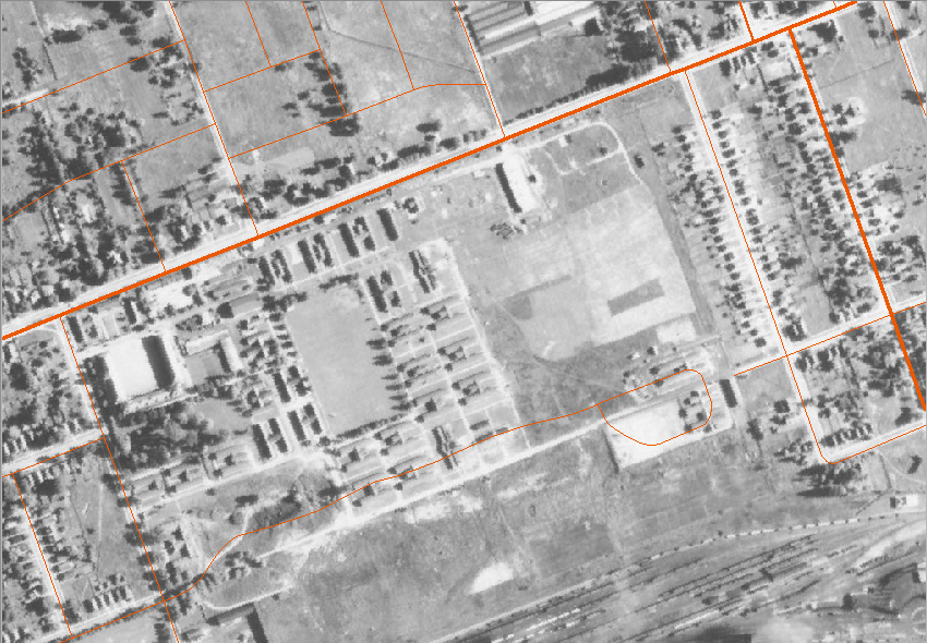
As I’m still waiting on the aerial photos for my assignment, I decided to fiddle around with QGIS so I’m more prepared when I do get my files. With the Western University Library’s digital coverage of London for selected years between 1922 and 1955, I decided to look for a London subject to test. Having visited CFB London (home of Wolseley Barracks) and the Royal Canadian Regiment Museum this summer at the 2013 OMMC Conference, I decided to take a look at how the base changed as a result of the Second World War.
The first step was to find something to use as a base map that I could then georeference the photos to. Using QGIS’s tool to add existing maps to my project, I used the “WMS-Toporama” map from Natural Resources Canada. Setting up my project to the appropriate coordinate system, I now had to georeference the pictures (assigning photographs with their geographic location).
The end result looks like this:
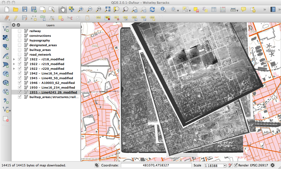
Looking at the layers individually, you can see the transformation of the site as Canada mobilized and demobilized for the Second World War. I left the road layer on as this is what I primarily used for georeferencing. You’ll notice it isn’t quite perfect but for what I needed, it does the job! Wolseley Barracks is the U-shaped building in the middle of the left hand side of the picture.


Now that I’ve figured out the georeferencing part, it is time to start looking at what else I can do with this program!

See the “Wolseley Barracks” posts on The Minute Book, companion blog to The Regimental Rogue, for some related history on the evolution of the Barracks.: http://regimentalrogue.tripod.com/blog/index.blog?topic_id=1129075