This post is long overdue but better late than never!
About a year-and-a-half ago, I started using iGIS, an iOS app that allows you to visualize geospatial data on your mobile device. My Professor, Josh MacFadyen, had demonstrated the possibilities of this app in our digital history class and I was eager to find ways to apply it to my own research. I had fiddled around with the app outside of class – see my post here – but didn’t have a chance to test it in the field.
In late summer, I finally had a chance to put it to the test. Using maps and aerial photographs I had georeferenced and converted, I uploaded my files to both my iPhone and an iPad and set off. Now the PoW camp I was visiting is somewhat remote – the nearest cellular signal was ten kilometers away and, needless to say, there was no wi-fi. Not sure how the program would work just using the devices’ internal GPS, I pre-loaded the satellite imagery (from Google) – a handy feature when you are in the bush – which would let me compare the historic imagery and maps with what the site looks like today.
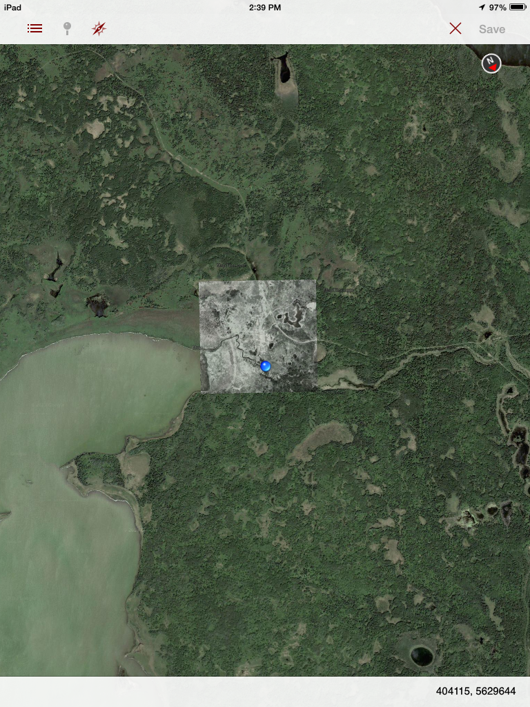
An hour by bike and I was at the site. I pulled out my phone and was pleasantly surprised to find that my phone’s internal GPS was accurate enough to show my location. As you can see from the image below, there are only a few signs hinting at the site’s history – all the more reason to find new technologies to fill in the gaps. The rectangular shape to the upper right of my position is the foundation of the camp’s powerhouse.

Things kept getting better for I discovered that the iPad worked as well – I was surprised for I wasn’t entirely sure that the iPad I was using had an internal GPS to begin with!
Having thrown in an aerial photograph from 1949 (above) and a forest inventory map from the 1930s (below) and I was in business! Adding a layer to show the physical layout of the camp as it appeared from 1943-1945 helped visualize the site and pinpoint some of the camp’s buildings and locations of interest.

While this is fantastic for my own research – I was able to identify tree stands cut by PoWs and see how the area has in some cases recovered or in others changed – it has important applications for public history as well. That same week, I led an interpretive PoW wagon tour, taking thirty people out to the site. As part of the tour, we provide visitors with a guidebook listing the buildings and explaining the history. Along with this we include a traditional map showing the layout of the site. While some of the footprints of the former buildings are visible if you look closely, it isn’t always easy to visualize the camp’s layout. However, with me leading a tour with an iPad, visitors were able to see exactly where they were standing in relation to the camp’s layout in the 1940s. Combining this with historic photos of the site and screenshots from my 3D model, visualizing the site became a whole lot easier!
That same week I visited the former PoW camp near Mafeking, Manitoba with the Beranek family, whose father/grandfather worked there in the latter war years. As I had only been to the site once before and was therefore much less familiar with this camp’s history than Riding Mountain, I relied pretty heavily on iGIS and an aerial photo to orient myself. I was also able to add the GPS waypoints I had taken on my handheld GPS the year before, seen as yellow dots in the image below.

Needles to say, using geospatial data on a mobile device opens up a realm of possibilities for both studying and sharing the past. While my use of the app and sources were fairly basic, I was able to visualize the site’s history, explore areas that I may have otherwise overlooked, and use non-traditional sources to better understand the relationship between history and the environment. Combining this with the ability to allow visitors to interact with landscape in new ways and let them explore on their own terms, I am eager to see how historians can use these technologies in the future.
With a major research trip (and some field work) planned for the summer, you can bet I’ll be bringing iGIS to help me explore and share the history of PoWs in Canada.

Technology is awesome! Go Digital Historians!