One of my more recent interests is the work of the Canadian Forestry Corps (CFC) during the First World War. The CFC was raised specifically to supply the Allied armies with a desperately-needed resource: timber. Whether it was to needed to support dugouts, hold barbed-wire, or aircraft frames, wood became one of the most basic resources of the First World War. Composed primarily of lumberjacks and foresters, the CFC eventually operated in France, England, and Scotland and succeeded in preventing a timber shortage. For a bit more of a background, you can read another of my posts here.
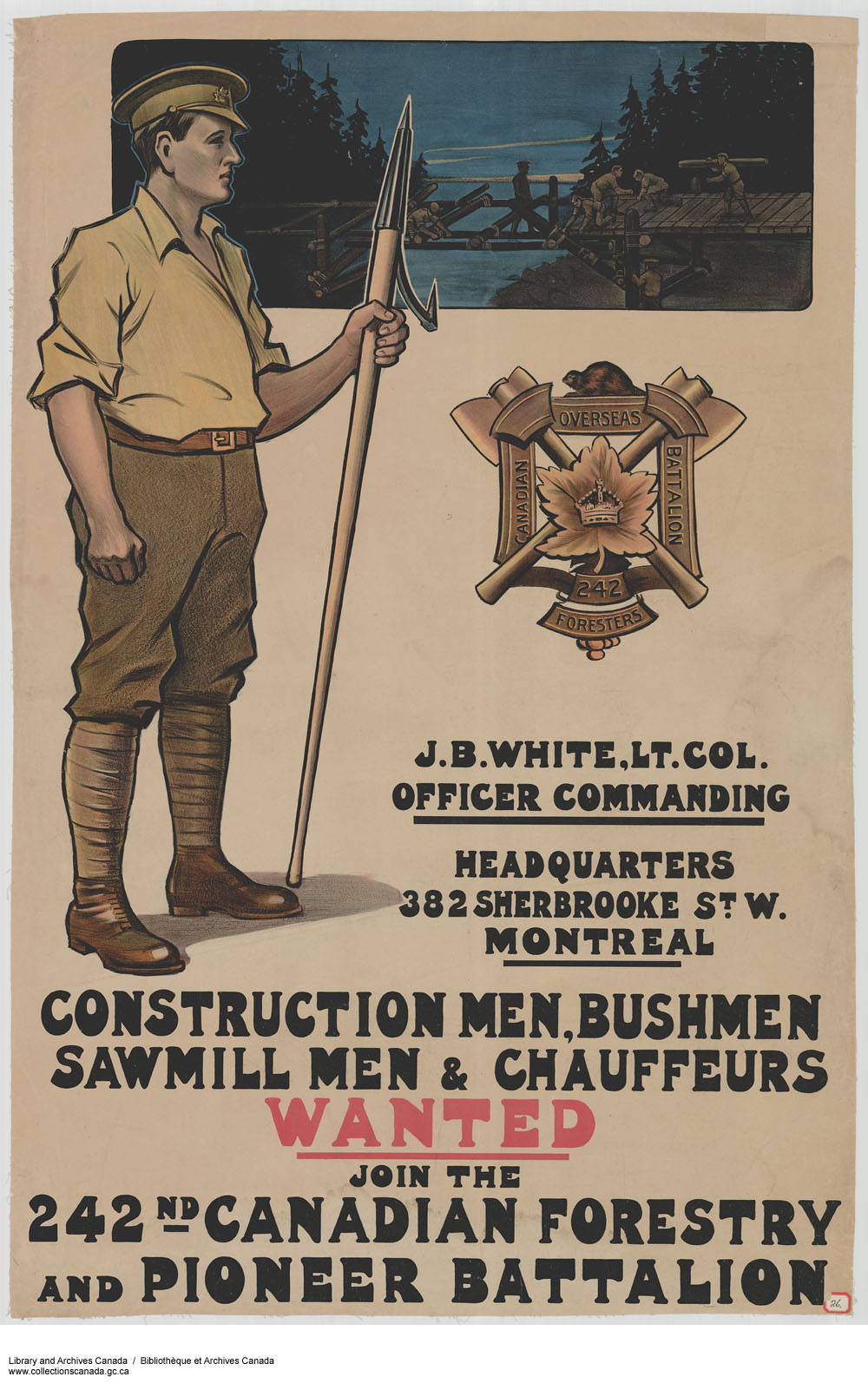
The CFC was organized into numbered companies of about 100-200 men and were assigned specific forests or woodlands to cut. One of these companies, the 107th (originally No. 7), received a timber limit in Keppernach, Scotland (South of Nairn in the Scottish Highlands). The area in which the company found itself in, the Forest of Cawdor, was no comparison to the Canadian “wilderness” they had left behind. Between 1825 and 1854, over fourteen million trees had been planted here, in an area covering just over 4,000 acres. The majority of the area was populated with Scotch Fir, the most-desired wood for wartime use.1
The company’s advance party of fifteen men arrived in late July 1916 and within ten days, had a Scotch mill up and running. A Canadian mill was built in August and the mills ran almost continuously until the camp closed in August 1917. By September 1917, the company had cut 6.5 million F.B.M. (foot board measure).2
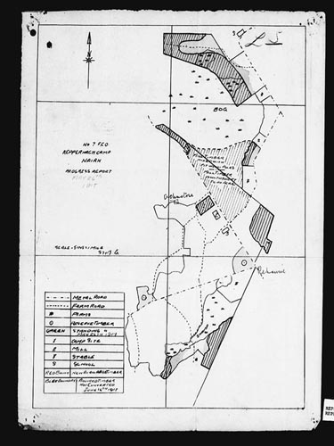
As I’m interested in the relationship between forests and war as well as forest regeneration, I decided to see what I could learn using GIS. Fortunately, the online war diary of the 107th Company includes a relatively uncommon map of the company’s operation at Keppernach.
Even more fortunate, when you search Keppernach in Google Maps, the first (and only) result is Keppernach Farm and takes you to the exact location the 107th Company worked in (see below). This saved me quite some time as I would have otherwise had to search all over Nairnshire for roads that matched up with my map.
In trying to locate some contemporary maps of the site, I discovered that Scotland, and Great Britain for that matter, has some great HGIS sources available online, notably A Vision of Britain Through Time and Old Maps Online. While some of these require you to live in Britain (A Vision of Britain) or charge for digital copies, I was able to get some high quality and detailed maps (here’s an example) from the National Library of Scotland. These maps were produced by the Ordnance Survey and published in 1905 so they provide the perfect backdrop to CFC operations in the following decade.
I then threw everything I had into Quantum GIS (QGIS) and georeferenced the maps.

Then adding the CFC map (in red)…
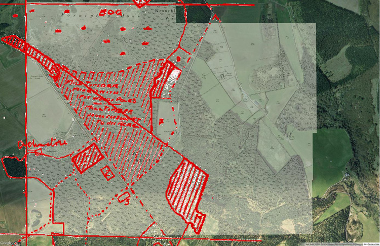
While the hand-drawn CFC map doesn’t line up perfectly with the other layers, it still provides a sufficient sense of what the operation looked like. I was somewhat surprised to find that from the air, it is impossible (for me at least) to tell that this forest had been completed cleared in 1917 and that the roads, pathways, and borders remain virtually unchanged. I also found it interesting in that the forested area had actually expanded (likely the result of interwar afforestation efforts brought about by the wartime shortage of timber) and that you can still make out the site of the Canadian camp (large rectangle on the left).
For the moment, this is a chance for me to refresh my GIS skills (which I apparently lost while home for the holidays) and a quick experiment to see what I can extract from the archival records. While it is very much a microhistory, I’m hoping that it will lead to some new information and insight into the role of the Canadian Forestry Corps.
Stay tuned to see what else I can find!
1. Historical Record, Keppernach Camp War Diary – 107th Company, War diaries – No. 51 District, Canadian Forestry Corps, Reel T-10901-10902, Volume 5018, Series III-D-3, RG 9, Library and Archives Canada.↩
2. Ibid↩
